Masada is not as much a holy site as a site with notable history. It was one of Herod's palaces, it was a fortress, and it was a place where it is believed that some of the people who wrote the Dead Sea Scrolls lived. In the revolt that led to the destruction of the Jerusalem Temple, Rome would send soldiers to utterly destroy things in the area. This led to the siege of Masada. Masada rises up on the west side of the Dead Sea. While the Dead Sea is the lowest place on surface of the earth, far below sea level, Masada rises up so far that it's above sea level by a few meters.


I have my ticket to ride.

Now to await a cable car to ride up. The guide bars for guiding the incoming cable cars into position almost look like big guns, but it's just a metal guide bar.


We're almost to the destination.


As one approaches the top, one sees some information about the cable car system.


The cup...

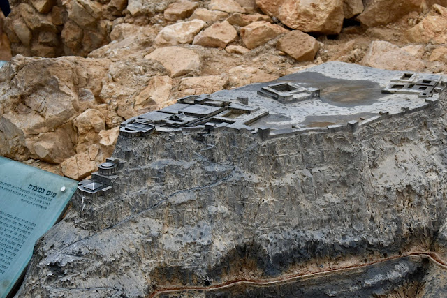
Another set of signs and model gives the general layout of the site.


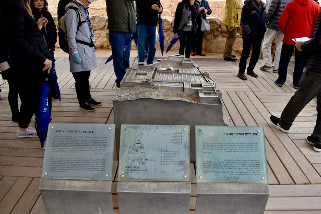

This is the Northern Palace. It had many rooms, including many storage rooms.


Looking to the north, we see the mountain ridge on the left and the Dead Sea to the right. The tectonic plates come together in the area of the Jordan River and the Dead Sea. The go down, making a low point. But the pressure and change in orientation can lead to the massive rising up of the landscape to the west of it. The road to this place was between the two.


The Dead Sea appears to have partitions in it. This view looks to the south, where the sea really does have divisions. I had seen that on maps before, and possibly even satellite/high-altitude photographs before, but I wasn't sure what it would be like in person. Well, now I know.

More views...I'll get to what's on top soon.


Here is an area that opens up a bit. It shows some of the view from the top, the view of the top, and many people from our group.

Here are a few places that I don't recall if we were told what they were. So just treat this as stuff at the top.


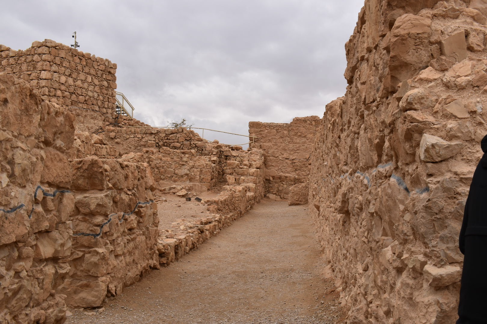
Here is a store room of the palace. They had several of these side-by-side. They were several feet wide and tens of feet long.

This one wasn't cleared out of the rubble.

Here's a better view of the side-by-side nature of them, and the clear rooms and the rooms where no one cleaned up after the destruction.


As usual, there is some artwork on the walls.


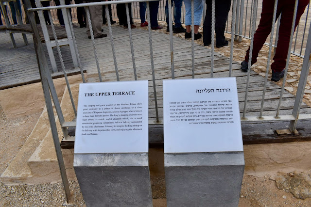
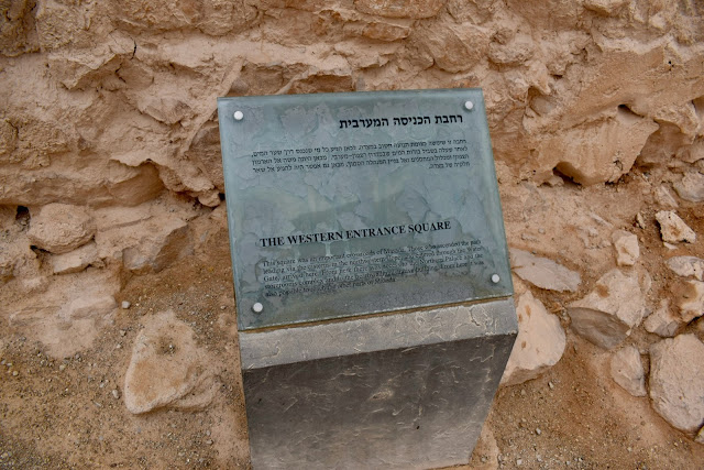
The Northern Palace has been mentioned, but now it's time to look at it. We remained at the top and didn't go lower down.


Here's a view from the north side.

Here is the same view, but tilted down to see the distinctive northern cliff.

The palace is the main structure in Masada (in my opinion), yet there will be plenty of interesting sites.


The large bathhouse was very notable. With so much water, they could enjoy a Roman bath. They had ways to heat it.


The windows are stone, just like most other windows of that era. But the color, darkened parts, and brightness in a place that has heated water almost makes it look like a furnace, but they are just windows.


The walls also have vents to allow proper heating.

After we stepped out, I noticed this and realized these are the glowing windows from the outside looking inward.


The map of the bathhouse appears below.
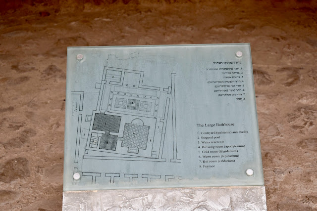
And...one more model, but this one only depicts the bathhouse.


If you don't know how to bathe, then here's your guide.

One bit of history suggests that the people here didn't want to be killed by the Romans. So a small group of men took the lives of others, and they drew lots to determine which among them would kill the others, and then die last. Our guide cast some doubt about this, pointing out that a VERY similar story took place elsewhere, and the same historian may have mixed the stories together.


I'm picking up the pace as we check out the western side.

The area of the guard rooms wasn't too significant, but I took a few photos in that area.


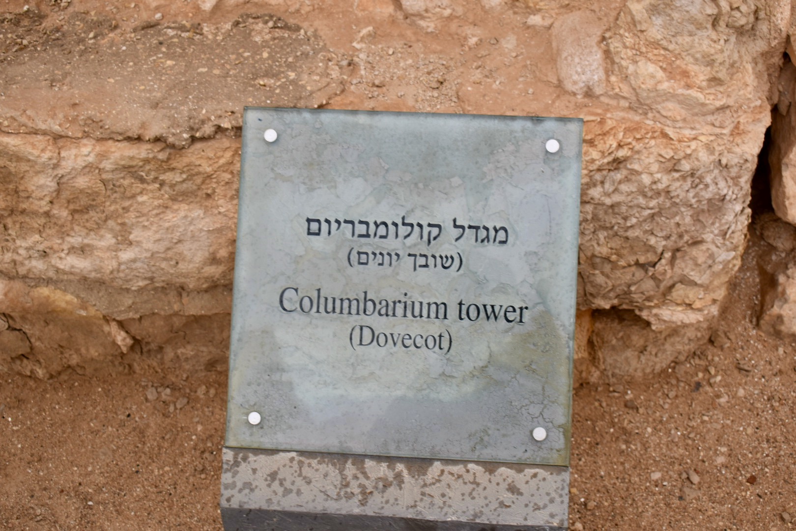
Nowadays, when I use the term Columbarium, I would usually use it to refer to a place of rest for the cremated remains of someone who has died. A columbarium in the days of Masada was the place where birds were raised, similar to a chicken coop, but made out of stone. The small cubbyholes housed the birds. When people looked for ways to store cremated remains in more modern times, they found the same structures that worked for raising birds useful in storing such remains. So this Columbarium has NOTHING to do with dead people.


One look at the floor and you can tell it's a Byzantine Church. That site is becoming very recognizable at this point.


Much earlier while at the top of Masada, I looked off the cliff and saw some modern utilities. I guess they had to serve modern needs somehow.

We started to gather before heading back down.

While waiting for the cable car, there were some birds that allowed us to get within inches of them.


 |
| View from Masada of Dead Sea and Jordan |
To view the sites I saw along the way from Bethany to Masada and a brief stop afterward before we headed to the Dead Sea, you can check out my prior post about the Desert. While most of my posts try to flow from one site to the next, that one was a stand-alone post, so the link will open in a new window so you can return to this part of the journey.
I took many photos in Masada. I knew nothing about Masada before the evening before showing up in Masada. I wasn't taking notes while up there, so I'm having to remember a great deal from photos months later.
While on the bus approaching our destination, I wasn't sure what the place would look like. But I saw something that stood out to me as unusual in the ridge line of the mountains to our west. There were large step-like cuts into the hillside. It looked odd or manmade enough to take photos of, and only as we approached and turned toward this feature did I realize this was our destination.
In the foreground of a few photos, we see the light tan-colored sandy land.


Since Masada is on a plateau, they offer a cable car to get up to the top. There is a walking path that takes a long time to walk up and down. The Romans knew they would face a literal uphill battle, so they had to create a gigantic mount of rock to ramp up to the side of this fortress. I believe that's what people use if they walk up to the top on foot.


Squeeze in everyone! It wasn't too tight of a fit, but quite a few people did have to fit in this thing.


Here are a few photos along the way or from the top.


There are several models of Masada or parts of it around the site. I will mention a few together, even though we saw sites between them. They like to point out that this high-up fortress would collect rain water into massive cisterns. They have a model that allows you to pour a cup of water over parts of the model to demonstrate this.


Long ago, these stepped down parts of the palace would have looked amazing and the view from them would likewise be amazing. But today, we just see the distinctive steps that drew my attention to the site.


Now that we have a few of the models and layout out of the way, I'll get back to getting off the cable car. We see a long line of people waiting for a ride down. We will pass by them.


Who's up for a view from the top? The Dead Sea is in the distance. The nation of Jordan is across the sea. And I love the landscape in the foreground.


I really like how the next three photos turned out in terms of color and composition.


A few years after the trip, I realized that if one looks down toward the south end of the Dead Sea from Masada, you're looking down on the region where Sodom and Gomorrah likely existed. They would likely have been visible in the photo below if they existed as cities today. Imagine the sight if someone was up this high at the time those cities were destroyed by fire from the sky.

At sites like this, when you see a bold, black line, it marks the divider between the original structures and the additions made to restore the structure to what it may have looked like previously. So anything above the line is modern, and below the line is ancient. They didn't just hand a child a paintbrush and leave the child alone for too long.


Although there is a lot of open space on the top of the mount, there are plenty of passages and rooms. Rock was usually used for the lower portions of walls throughout the land. Upper parts might be mud or other materials, and then ceilings can bridge across the top. I assume the same is true here.


Here is a view off the side, facing toward the north. That Northern Palace with its characteristic steps.


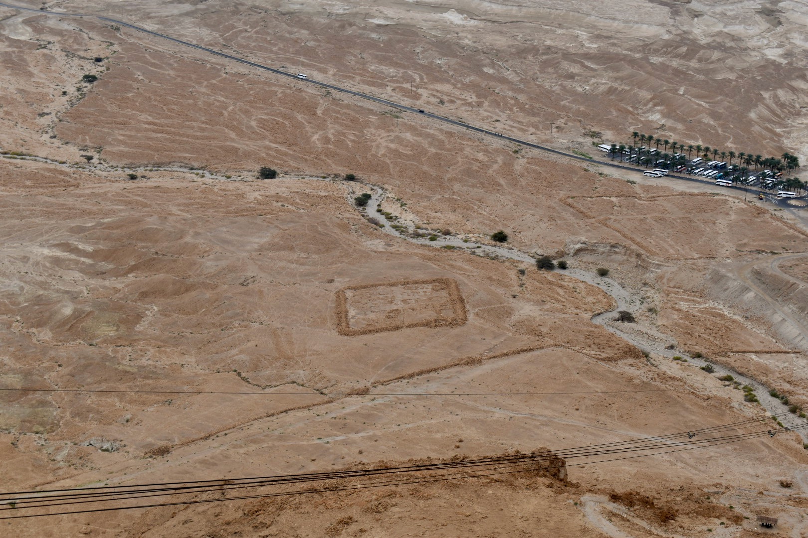
I took several photos from the top looking out and a few looking down. The siege houses showed up as distinct squares on the landscape. I wasn't sure quite what they looked like near ground level, but I saw them closer on the way down. Just on this side of the square, we see the siege wall that rose up all the way around to prevent easy escape from Masada. The sad thing is that the people on top at the time of the siege had moved away from Jerusalem due to the problems they saw there. The Temple desecration and corruption of the people who managed the Temple's affairs was so bad that they wanted nothing to do with it. Yet, when those people revolted, Rome sought to wipe out all that they could. Something makes me wonder if they could have talked this one through by making it clear that both they and the Romans opposed what was going on in Jerusalem.


I believe these small columns are pretty standard in heated baths.


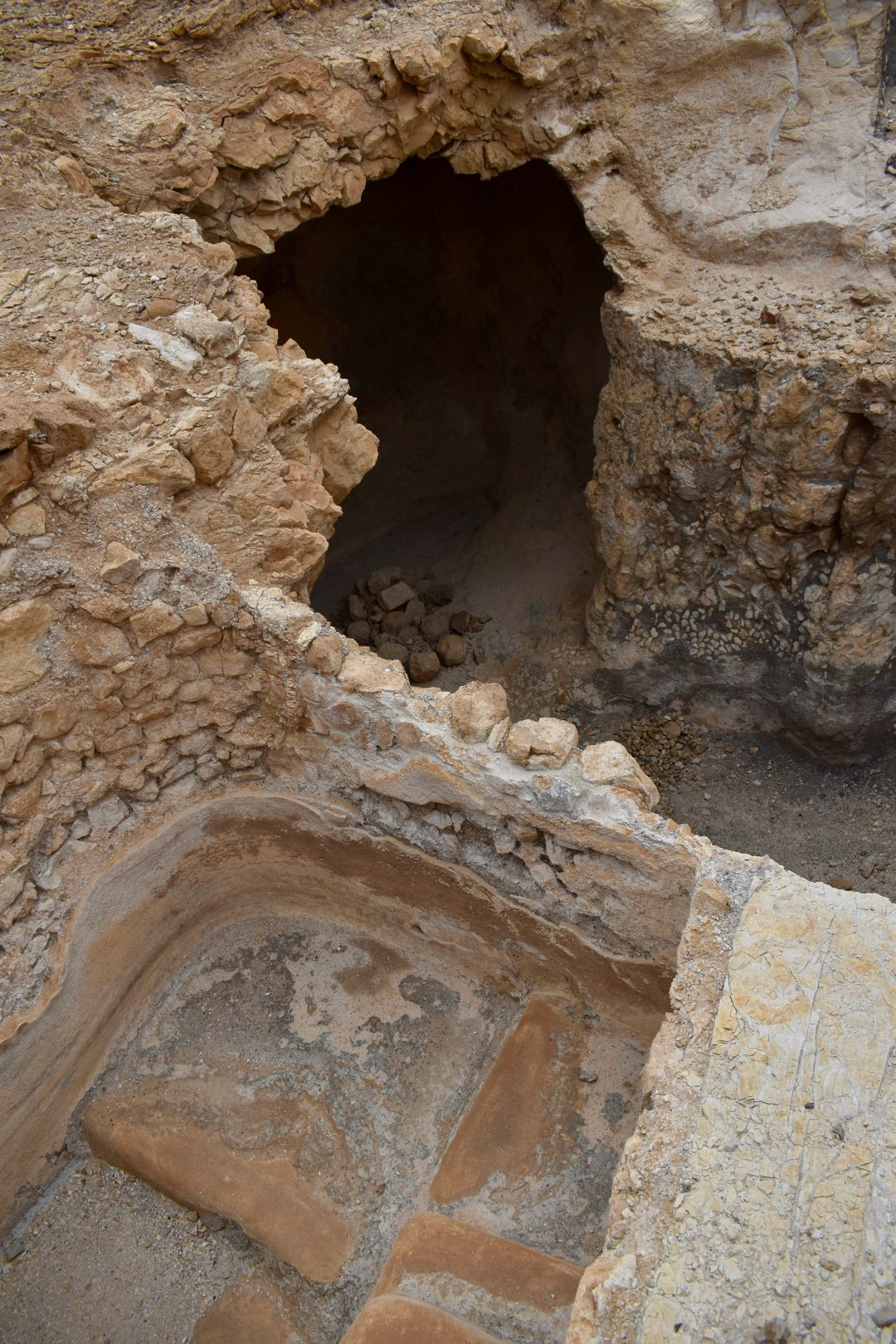
We start to see the kind of place we will go next. There are huge pits that serve as cisterns.


We checked out the old Byzantine Church.


There was also an ancient Synagogue at the top. It had the characteristic steps.


Before reaching the bottom, I saw one of those siege houses at a better angle.


One last photo from the top was taken in panoramic mode.

There was more religious stuff at this site than I expected, but I still couldn't wait to check out more holy sites. But I knew we were going to check out the Dead Sea.
Comments
Post a Comment